Microsite
- Client: Oxfam America
- Firm: Beam Interactive
- Role: Art & Creative Direction
- Online: adapt.oxfamamerica.org
Warning: Flash (hey, it was a different time)
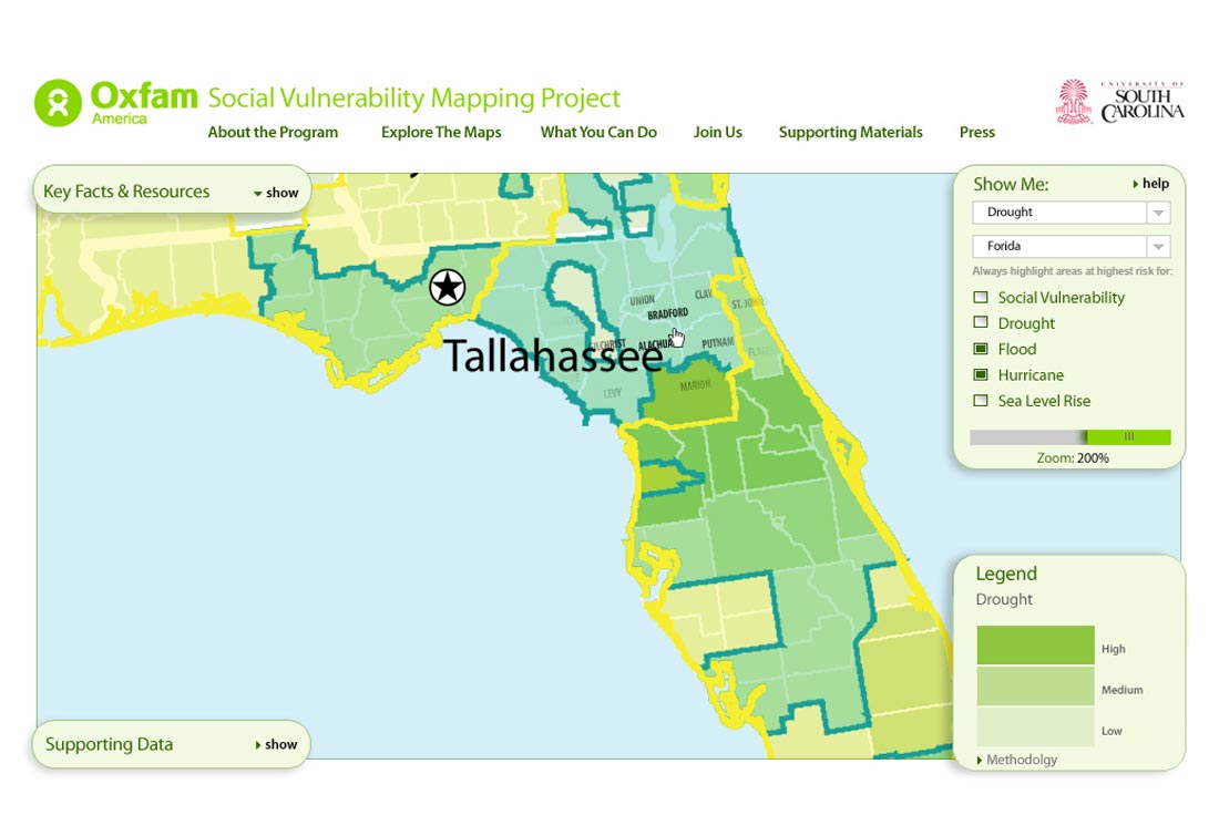
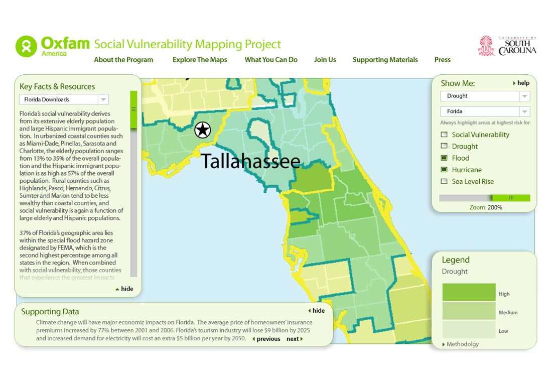
With more than 60 years of experience as a leading global humanitarian aid agency, Oxfam has particular insight into the effects climate change can have on at-risk communities, but research rarely considered the confluence of different climate events and the impact in specific geographic areas. They came to us to help illustrate that risk
From the client: "This research, commissioned by Oxfam America, includes a series of layered maps that depict social and climate change-related hazard vulnerability. The maps assist in identifying hotspots in the Southeastern United States that are at significant risk in the face of four particular climate change-related hazards: drought, flooding, hurricane-force winds, and sea level rise. The specific region of focus is the 12-state area encompassing AL, AR, FL, GA, KY, LA, MD, MI, VA, SC, TN, and TX."
Click any work for a slide show and full descriptions.